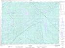
Maps showing Ruisseau Pagé, Lac-Lenôtre; La Vallée-de-la-Gatineau, Quebec
Ruisseau Pagé is a River located in Lac-Lenôtre; La Vallée-de-la-Gatineau, Quebec.
- Latitude: 47° 25' 51'' North (decimal: 47.4309018)
- Longitude: 75° 51' 14'' West (decimal: -75.8538096)
- Topography Feature Category: River
- Geographical Feature: Ruisseau
- Canadian Province/Territory: Quebec
- Location: Lac-Lenôtre; La Vallée-de-la-Gatineau
- Atlas of Canada Locator Map: Ruisseau Pagé
- GPS Coordinate Locator Map: Ruisseau Pagé Lat/Long
Ruisseau Pagé NTS Map Sheets