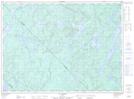
Maps showing Baie Stanley, Lac-De La Bidière; Antoine-Labelle, Quebec
Baie Stanley is a Bay located in Lac-De La Bidière; Antoine-Labelle, Quebec.
- Latitude: 47° 26' 22'' North (decimal: 47.4395095)
- Longitude: 74° 58' 59'' West (decimal: -74.9829403)
- Topography Feature Category: Bay
- Geographical Feature: Baie
- Canadian Province/Territory: Quebec
- Location: Lac-De La Bidière; Antoine-Labelle
- Atlas of Canada Locator Map: Baie Stanley
- GPS Coordinate Locator Map: Baie Stanley Lat/Long
Baie Stanley NTS Map Sheets