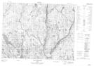
Maps showing Lac du Bourricot, Mont-Valin; Le Fjord-du-Saguenay, Quebec
Lac du Bourricot is a Lake located in Mont-Valin; Le Fjord-du-Saguenay, Quebec.
- Latitude: 49° 32' 55'' North (decimal: 49.5486503)
- Longitude: 71° 5' 38'' West (decimal: -71.0939403)
- Topography Feature Category: Lake
- Geographical Feature: Lac
- Canadian Province/Territory: Quebec
- Location: Mont-Valin; Le Fjord-du-Saguenay
- Atlas of Canada Locator Map: Lac du Bourricot
- GPS Coordinate Locator Map: Lac du Bourricot Lat/Long
Lac du Bourricot NTS Map Sheets