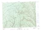
Maps showing Le Moulin-Lacroix, Lac-Casault; La Matapédia, Quebec
Le Moulin-Lacroix is a Unincorporated area located in Lac-Casault; La Matapédia, Quebec.
- Latitude: 48° 28' 19'' North (decimal: 48.4719916)
- Longitude: 66° 45' 10'' West (decimal: -66.7527456)
- Topography Feature Category: Unincorporated area
- Geographical Feature: Lieu-dit
- Canadian Province/Territory: Quebec
- Location: Lac-Casault; La Matapédia
- Atlas of Canada Locator Map: Le Moulin-Lacroix
- GPS Coordinate Locator Map: Le Moulin-Lacroix Lat/Long
Le Moulin-Lacroix NTS Map Sheets