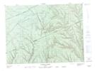
Maps showing Côte Rouge, Lac-Casault; La Matapédia, Quebec
Côte Rouge is a Road feature located in Lac-Casault; La Matapédia, Quebec.
- Latitude: 48° 28' 44'' North (decimal: 48.4789361)
- Longitude: 66° 35' 53'' West (decimal: -66.5980178)
- Topography Feature Category: Road feature
- Geographical Feature: Côte
- Canadian Province/Territory: Quebec
- Location: Lac-Casault; La Matapédia
- Atlas of Canada Locator Map: Côte Rouge
- GPS Coordinate Locator Map: Côte Rouge Lat/Long
Côte Rouge NTS Map Sheets