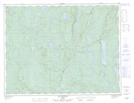
Maps showing Rivière Amariton, Rivière-aux-Outardes; Manicouagan, Quebec
Rivière Amariton is a River located in Rivière-aux-Outardes; Manicouagan, Quebec.
- Latitude: 49° 45' 17'' North (decimal: 49.7547713)
- Longitude: 68° 2' 3'' West (decimal: -68.0341884)
- Topography Feature Category: River
- Geographical Feature: Rivière
- Canadian Province/Territory: Quebec
- Location: Rivière-aux-Outardes; Manicouagan
- Atlas of Canada Locator Map: Rivière Amariton
- GPS Coordinate Locator Map: Rivière Amariton Lat/Long
Rivière Amariton NTS Map Sheets