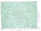
Maps showing Lac-Marcotte, Saint-Alexis-des-Monts; Maskinongé, Quebec
Lac-Marcotte is a Other municipal/district area - miscellaneous located in Saint-Alexis-des-Monts; Maskinongé, Quebec.
- Latitude: 46° 47' North (decimal: 46.7832999)
- Longitude: 73° 12' West (decimal: -73.1999999)
- Topography Feature Category: Other municipal/district area - miscellaneous
- Geographical Feature: Territoire non organisé
- Canadian Province/Territory: Quebec
- Location: Saint-Alexis-des-Monts; Maskinongé
- GPS Coordinate Locator Map: Lac-Marcotte Lat/Long
Lac-Marcotte NTS Map Sheets