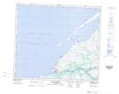
Maps showing Ruisseau Kuugajaaraapik, Whapmagoostui; Jamésie, Quebec
Ruisseau Kuugajaaraapik is a River located in Whapmagoostui; Jamésie, Quebec and has an elevation of 37 meters.
- Latitude: 55° 15' 51'' North (decimal: 55.2640392)
- Longitude: 77° 46' 41'' West (decimal: -77.7780870)
- Topography Feature Category: River
- Geographical Feature: Ruisseau
- Canadian Province/Territory: Quebec
- Elevation: 37 meters
- Location: Whapmagoostui; Jamésie
- Atlas of Canada Locator Map: Ruisseau Kuugajaaraapik
- GPS Coordinate Locator Map: Ruisseau Kuugajaaraapik Lat/Long
Ruisseau Kuugajaaraapik NTS Map Sheets