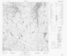
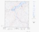
Maps showing Ruisseau Kikkaluk, Salluit; Kativik, Quebec
Ruisseau Kikkaluk is a River located in Salluit; Kativik, Quebec and has an elevation of 80 meters.
- Latitude: 62° 13' 46'' North (decimal: 62.2294698)
- Longitude: 75° 35' 53'' West (decimal: -75.5981150)
- Topography Feature Category: River
- Geographical Feature: Ruisseau
- Canadian Province/Territory: Quebec
- Elevation: 80 meters
- Location: Salluit; Kativik
- Atlas of Canada Locator Map: Ruisseau Kikkaluk
- GPS Coordinate Locator Map: Ruisseau Kikkaluk Lat/Long
Ruisseau Kikkaluk NTS Map Sheets