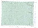
Maps showing Sommet de Chaillot, Lac-Pikauba; Charlevoix, Quebec
Sommet de Chaillot is a Mountain located in Lac-Pikauba; Charlevoix, Quebec.
- Latitude: 47° 48' 11'' North (decimal: 47.8030831)
- Longitude: 70° 52' 19'' West (decimal: -70.8720297)
- Topography Feature Category: Mountain
- Geographical Feature: Mont
- Canadian Province/Territory: Quebec
- Location: Lac-Pikauba; Charlevoix
- Atlas of Canada Locator Map: Sommet de Chaillot
- GPS Coordinate Locator Map: Sommet de Chaillot Lat/Long
Sommet de Chaillot NTS Map Sheets