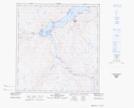
Maps showing Iqalulik, Baie-d'Hudson; Kativik, Quebec
Iqalulik is a River feature located in Baie-d'Hudson; Kativik, Quebec.
- Latitude: 62° 0' 11'' North (decimal: 62.0030824)
- Longitude: 75° 31' 8'' West (decimal: -75.5189488)
- Topography Feature Category: River feature
- Geographical Feature: Lieu de pêche
- Canadian Province/Territory: Quebec
- Location: Baie-d'Hudson; Kativik
- Atlas of Canada Locator Map: Iqalulik
- GPS Coordinate Locator Map: Iqalulik Lat/Long