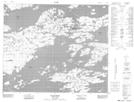
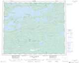
Maps showing Centrale La Grande-3, Baie-James; Jamésie, Quebec
Centrale La Grande-3 is a Hydraulic construction located in Baie-James; Jamésie, Quebec.
- Latitude: 53° 43' 40'' North (decimal: 53.7278964)
- Longitude: 75° 59' 54'' West (decimal: -75.9983018)
- Topography Feature Category: Hydraulic construction
- Geographical Feature: Centrale hydroélectrique
- Canadian Province/Territory: Quebec
- Location: Baie-James; Jamésie
- Atlas of Canada Locator Map: Centrale La Grande-3
- GPS Coordinate Locator Map: Centrale La Grande-3 Lat/Long
Centrale La Grande-3 NTS Map Sheets