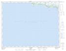
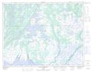
Maps showing Rivière de l'Île Michon, Aguanish; Minganie, Quebec
Rivière de l'Île Michon is a River located in Aguanish; Minganie, Quebec.
- Latitude: 50° 13' 18'' North (decimal: 50.2217389)
- Longitude: 62° 1' 11'' West (decimal: -62.0198202)
- Topography Feature Category: River
- Geographical Feature: Rivière
- Canadian Province/Territory: Quebec
- Location: Aguanish; Minganie
- Atlas of Canada Locator Map: Rivière de l'Île Michon
- GPS Coordinate Locator Map: Rivière de l'Île Michon Lat/Long
Rivière de l'Île Michon NTS Map Sheets