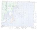
Maps showing Rivière de l'Ouest, Côte-Nord-du-Golfe-du-Saint-Laurent; Basse-Côte-Nord, Quebec
Rivière de l'Ouest is a River located in Côte-Nord-du-Golfe-du-Saint-Laurent; Basse-Côte-Nord, Quebec.
- Latitude: 50° 41' 55'' North (decimal: 50.6986690)
- Longitude: 59° 19' 35'' West (decimal: -59.3263667)
- Topography Feature Category: River
- Geographical Feature: Rivière
- Canadian Province/Territory: Quebec
- Location: Côte-Nord-du-Golfe-du-Saint-Laurent; Basse-Côte-Nord
- Atlas of Canada Locator Map: Rivière de l'Ouest
- GPS Coordinate Locator Map: Rivière de l'Ouest Lat/Long
Rivière de l'Ouest NTS Map Sheets