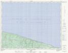
Maps showing Rivière du Castor, L'Île-d'Anticosti; Minganie, Quebec
Rivière du Castor is a River located in L'Île-d'Anticosti; Minganie, Quebec.
- Latitude: 49° 48' 24'' North (decimal: 49.8067346)
- Longitude: 63° 17' 15'' West (decimal: -63.2876319)
- Topography Feature Category: River
- Geographical Feature: Rivière
- Canadian Province/Territory: Quebec
- Location: L'Île-d'Anticosti; Minganie
- Atlas of Canada Locator Map: Rivière du Castor
- GPS Coordinate Locator Map: Rivière du Castor Lat/Long
Rivière du Castor NTS Map Sheets