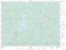
Maps showing Base-Radar, La Tuque; Le Haut-Saint-Maurice, Quebec
Base-Radar is a Unincorporated area located in La Tuque; Le Haut-Saint-Maurice, Quebec.
- Latitude: 47° 54' 6'' North (decimal: 47.9017353)
- Longitude: 74° 39' 9'' West (decimal: -74.6523637)
- Topography Feature Category: Unincorporated area
- Geographical Feature: Secteur résidentiel
- Canadian Province/Territory: Quebec
- Location: La Tuque; Le Haut-Saint-Maurice
- Atlas of Canada Locator Map: Base-Radar
- GPS Coordinate Locator Map: Base-Radar Lat/Long