Maps showing Le Haut des Limbes, Caniapiscau; Caniapiscau, Quebec
Le Haut des Limbes is a Island located in Caniapiscau; Caniapiscau, Quebec.
- Latitude: 54° 45' 18'' North (decimal: 54.7551162)
- Longitude: 69° 42' 49'' West (decimal: -69.7135583)
- Topography Feature Category: Island
- Geographical Feature: Île / Ile
- Canadian Province/Territory: Quebec
- Location: Caniapiscau; Caniapiscau
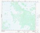
- Atlas of Canada Locator Map: Le Haut des Limbes
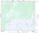
- GPS Coordinate Locator Map: Le Haut des Limbes Lat/Long
Le Haut des Limbes NTS Map Sheets