Maps showing La Dérive Douce, Caniapiscau; Caniapiscau, Quebec
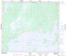
La Dérive Douce is a Island located in Caniapiscau; Caniapiscau, Quebec.
- Latitude: 54° 46' 33'' North (decimal: 54.7759489)
- Longitude: 69° 35' 47'' West (decimal: -69.5963287)
- Topography Feature Category: Island
- Geographical Feature: Île / Ile
- Canadian Province/Territory: Quebec
- Location: Caniapiscau; Caniapiscau
- Atlas of Canada Locator Map: La Dérive Douce
- GPS Coordinate Locator Map: La Dérive Douce Lat/Long
La Dérive Douce NTS Map Sheets