Maps showing Le Vent du Diable, Caniapiscau; Caniapiscau, Quebec
Le Vent du Diable is a Island located in Caniapiscau; Caniapiscau, Quebec.
- Latitude: 54° 46' 3'' North (decimal: 54.7676170)
- Longitude: 69° 48' 30'' West (decimal: -69.8082871)
- Topography Feature Category: Island
- Geographical Feature: Île / Ile
- Canadian Province/Territory: Quebec
- Location: Caniapiscau; Caniapiscau
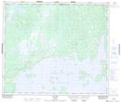
- Atlas of Canada Locator Map: Le Vent du Diable
- GPS Coordinate Locator Map: Le Vent du Diable Lat/Long
Le Vent du Diable NTS Map Sheets