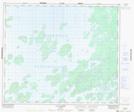
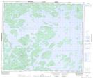
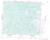
Maps showing Le Visage Clos, Caniapiscau; Caniapiscau, Quebec
Le Visage Clos is a Island located in Caniapiscau; Caniapiscau, Quebec.
- Latitude: 54° 27' 42'' North (decimal: 54.4617831)
- Longitude: 69° 59' 44'' West (decimal: -69.9955256)
- Topography Feature Category: Island
- Geographical Feature: Île / Ile
- Canadian Province/Territory: Quebec
- Location: Caniapiscau; Caniapiscau
- Atlas of Canada Locator Map: Le Visage Clos
- GPS Coordinate Locator Map: Le Visage Clos Lat/Long
Le Visage Clos NTS Map Sheets