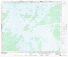
Maps showing Le Coeur Éclaté, Caniapiscau; Caniapiscau, Quebec
Le Coeur Éclaté is a Island located in Caniapiscau; Caniapiscau, Quebec.
- Latitude: 54° 10' 57'' North (decimal: 54.1826135)
- Longitude: 69° 49' 48'' West (decimal: -69.8299663)
- Topography Feature Category: Island
- Geographical Feature: Île / Ile
- Canadian Province/Territory: Quebec
- Location: Caniapiscau; Caniapiscau
- Atlas of Canada Locator Map: Le Coeur Éclaté
- GPS Coordinate Locator Map: Le Coeur Éclaté Lat/Long