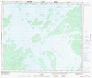
Maps showing La Statue de Fer, Caniapiscau; Caniapiscau, Quebec
La Statue de Fer is a Island located in Caniapiscau; Caniapiscau, Quebec.
- Latitude: 54° 6' 42'' North (decimal: 54.1117801)
- Longitude: 69° 58' 6'' West (decimal: -69.9683078)
- Topography Feature Category: Island
- Geographical Feature: Île / Ile
- Canadian Province/Territory: Quebec
- Location: Caniapiscau; Caniapiscau
- Atlas of Canada Locator Map: La Statue de Fer
- GPS Coordinate Locator Map: La Statue de Fer Lat/Long