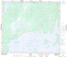
Maps showing La Calliope, Caniapiscau; Caniapiscau, Quebec
La Calliope is a Island located in Caniapiscau; Caniapiscau, Quebec.
- Latitude: 54° 47' 33'' North (decimal: 54.7926152)
- Longitude: 69° 32' 28'' West (decimal: -69.5410480)
- Topography Feature Category: Island
- Geographical Feature: Île / Ile
- Canadian Province/Territory: Quebec
- Location: Caniapiscau; Caniapiscau
- Atlas of Canada Locator Map: La Calliope
- GPS Coordinate Locator Map: La Calliope Lat/Long
La Calliope NTS Map Sheets