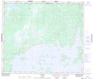
Maps showing L'Ancre à Voiles, Caniapiscau; Caniapiscau, Quebec
L'Ancre à Voiles is a Island located in Caniapiscau; Caniapiscau, Quebec.
- Latitude: 54° 50' 54'' North (decimal: 54.8484502)
- Longitude: 69° 40' 1'' West (decimal: -69.6668870)
- Topography Feature Category: Island
- Geographical Feature: Île / Ile
- Canadian Province/Territory: Quebec
- Location: Caniapiscau; Caniapiscau
- Atlas of Canada Locator Map: L'Ancre à Voiles
- GPS Coordinate Locator Map: L'Ancre à Voiles Lat/Long
L'Ancre à Voiles NTS Map Sheets