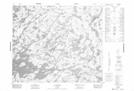
Maps showing La Fleur de Lyse, Caniapiscau; Caniapiscau, Quebec
La Fleur de Lyse is a Island located in Caniapiscau; Caniapiscau, Quebec.
- Latitude: 54° 3' 30'' North (decimal: 54.0584416)
- Longitude: 69° 26' 38'' West (decimal: -69.4438405)
- Topography Feature Category: Island
- Geographical Feature: Île / Ile
- Canadian Province/Territory: Quebec
- Location: Caniapiscau; Caniapiscau
- Atlas of Canada Locator Map: La Fleur de Lyse
- GPS Coordinate Locator Map: La Fleur de Lyse Lat/Long
La Fleur de Lyse NTS Map Sheets