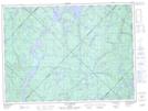
Maps showing Mauricie--Bois-Francs, Lac-Normand; Mékinac, Quebec
Mauricie--Bois-Francs is a Major municipal/district area - major agglomeration located in Lac-Normand; Mékinac, Quebec.
- Latitude: 47° 9' North (decimal: 47.1500000)
- Longitude: 72° 56' West (decimal: -72.9332999)
- Topography Feature Category: Major municipal/district area - major agglomeration
- Geographical Feature: Région administrative
- Canadian Province/Territory: Quebec
- Location: Lac-Normand; Mékinac
- GPS Coordinate Locator Map: Mauricie--Bois-Francs Lat/Long
Mauricie--Bois-Francs NTS Map Sheets