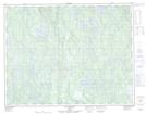
Maps showing Étang du Haut, Lac-Jérôme; Minganie, Quebec
Étang du Haut is a Lake located in Lac-Jérôme; Minganie, Quebec.
- Latitude: 50° 44' 32'' North (decimal: 50.7422901)
- Longitude: 62° 23' 18'' West (decimal: -62.3884389)
- Topography Feature Category: Lake
- Geographical Feature: Étang
- Canadian Province/Territory: Quebec
- Location: Lac-Jérôme; Minganie
- Atlas of Canada Locator Map: Étang du Haut
- GPS Coordinate Locator Map: Étang du Haut Lat/Long
Étang du Haut NTS Map Sheets