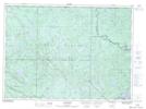
Maps showing Pitòbìg Sàgahigan, Lac-Marguerite; Antoine-Labelle, Quebec
Pitòbìg Sàgahigan is a Lake located in Lac-Marguerite; Antoine-Labelle, Quebec.
- Latitude: 46° 54' 0'' North (decimal: 46.9000606)
- Longitude: 76° 1' 24'' West (decimal: -76.0232733)
- Topography Feature Category: Lake
- Geographical Feature: Lac
- Canadian Province/Territory: Quebec
- Location: Lac-Marguerite; Antoine-Labelle
- GPS Coordinate Locator Map: Pitòbìg Sàgahigan Lat/Long
Pitòbìg Sàgahigan NTS Map Sheets