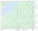
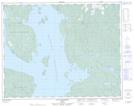
Maps showing Lac du Tête-à-Queue, Rivière-aux-Outardes; Manicouagan, Quebec
Lac du Tête-à-Queue is a Lake located in Rivière-aux-Outardes; Manicouagan, Quebec.
- Latitude: 51° 24' 34'' North (decimal: 51.4094798)
- Longitude: 68° 23' 47'' West (decimal: -68.3963636)
- Topography Feature Category: Lake
- Geographical Feature: Lac
- Canadian Province/Territory: Quebec
- Location: Rivière-aux-Outardes; Manicouagan
- Atlas of Canada Locator Map: Lac du Tête-à-Queue
- GPS Coordinate Locator Map: Lac du Tête-à-Queue Lat/Long
Lac du Tête-à-Queue NTS Map Sheets