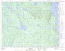
Maps showing Lac du Dard, Rivière-aux-Outardes; Manicouagan, Quebec
Lac du Dard is a Lake located in Rivière-aux-Outardes; Manicouagan, Quebec.
- Latitude: 51° 16' 52'' North (decimal: 51.2811521)
- Longitude: 68° 39' 57'' West (decimal: -68.6658239)
- Topography Feature Category: Lake
- Geographical Feature: Lac
- Canadian Province/Territory: Quebec
- Location: Rivière-aux-Outardes; Manicouagan
- Atlas of Canada Locator Map: Lac du Dard
- GPS Coordinate Locator Map: Lac du Dard Lat/Long
Lac du Dard NTS Map Sheets