Maps showing Île à Caribous, Rivière-aux-Outardes; Manicouagan, Quebec
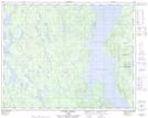
Île à Caribous is a Island located in Rivière-aux-Outardes; Manicouagan, Quebec.
- Latitude: 51° 29' 30'' North (decimal: 51.4917070)
- Longitude: 69° 12' 29'' West (decimal: -69.2080373)
- Topography Feature Category: Island
- Geographical Feature: Île / Ile
- Canadian Province/Territory: Quebec
- Location: Rivière-aux-Outardes; Manicouagan
- Atlas of Canada Locator Map: Île à Caribous
- GPS Coordinate Locator Map: Île à Caribous Lat/Long
Île à Caribous NTS Map Sheets