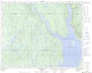
Maps showing Mont Roland, Rivière-aux-Outardes; Manicouagan, Quebec
Mont Roland is a Mountain located in Rivière-aux-Outardes; Manicouagan, Quebec.
- Latitude: 51° 30' 9'' North (decimal: 51.5025398)
- Longitude: 69° 12' 34'' West (decimal: -69.2094254)
- Topography Feature Category: Mountain
- Geographical Feature: Mont
- Canadian Province/Territory: Quebec
- Location: Rivière-aux-Outardes; Manicouagan
- Atlas of Canada Locator Map: Mont Roland
- GPS Coordinate Locator Map: Mont Roland Lat/Long
Mont Roland NTS Map Sheets