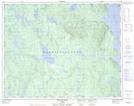
Maps showing Lac des Collerettes, Rivière-aux-Outardes; Manicouagan, Quebec
Lac des Collerettes is a Lake located in Rivière-aux-Outardes; Manicouagan, Quebec.
- Latitude: 51° 18' 28'' North (decimal: 51.3078228)
- Longitude: 68° 58' 38'' West (decimal: -68.9772186)
- Topography Feature Category: Lake
- Geographical Feature: Lac
- Canadian Province/Territory: Quebec
- Location: Rivière-aux-Outardes; Manicouagan
- Atlas of Canada Locator Map: Lac des Collerettes
- GPS Coordinate Locator Map: Lac des Collerettes Lat/Long
Lac des Collerettes NTS Map Sheets