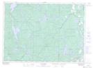
Maps showing Ashage Sàgahigan, Kitigan Zibi; La Vallée-de-la-Gatineau, Quebec
Ashage Sàgahigan is a Lake located in Kitigan Zibi; La Vallée-de-la-Gatineau, Quebec.
- Latitude: 46° 20' 48'' North (decimal: 46.3467220)
- Longitude: 76° 8' 37'' West (decimal: -76.1435685)
- Topography Feature Category: Lake
- Geographical Feature: Lac
- Canadian Province/Territory: Quebec
- Location: Kitigan Zibi; La Vallée-de-la-Gatineau
- GPS Coordinate Locator Map: Ashage Sàgahigan Lat/Long
Ashage Sàgahigan NTS Map Sheets