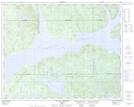
Maps showing Lac Pelleteur, Rivière-Mouchalagane; Caniapiscau, Quebec
Lac Pelleteur is a Lake located in Rivière-Mouchalagane; Caniapiscau, Quebec.
- Latitude: 51° 35' 28'' North (decimal: 51.5911595)
- Longitude: 68° 41' 39'' West (decimal: -68.6941355)
- Topography Feature Category: Lake
- Geographical Feature: Lac
- Canadian Province/Territory: Quebec
- Location: Rivière-Mouchalagane; Caniapiscau
- Atlas of Canada Locator Map: Lac Pelleteur
- GPS Coordinate Locator Map: Lac Pelleteur Lat/Long
Lac Pelleteur NTS Map Sheets