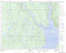
Maps showing Lac des Bois Noirs, Rivière-Mouchalagane; Caniapiscau, Quebec
Lac des Bois Noirs is a Lake located in Rivière-Mouchalagane; Caniapiscau, Quebec.
- Latitude: 51° 35' 58'' North (decimal: 51.5994892)
- Longitude: 69° 26' 18'' West (decimal: -69.4383216)
- Topography Feature Category: Lake
- Geographical Feature: Lac
- Canadian Province/Territory: Quebec
- Location: Rivière-Mouchalagane; Caniapiscau
- Atlas of Canada Locator Map: Lac des Bois Noirs
- GPS Coordinate Locator Map: Lac des Bois Noirs Lat/Long
Lac des Bois Noirs NTS Map Sheets