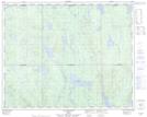
Maps showing Lac du Canard Envolé, Rivière-Mouchalagane; Caniapiscau, Quebec
Lac du Canard Envolé is a Lake located in Rivière-Mouchalagane; Caniapiscau, Quebec.
- Latitude: 51° 56' 13'' North (decimal: 51.9369923)
- Longitude: 68° 38' 19'' West (decimal: -68.6385629)
- Topography Feature Category: Lake
- Geographical Feature: Lac
- Canadian Province/Territory: Quebec
- Location: Rivière-Mouchalagane; Caniapiscau
- Atlas of Canada Locator Map: Lac du Canard Envolé
- GPS Coordinate Locator Map: Lac du Canard Envolé Lat/Long
Lac du Canard Envolé NTS Map Sheets