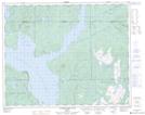
Maps showing Lac Voltigeur, Rivière-Mouchalagane; Caniapiscau, Quebec
Lac Voltigeur is a Lake located in Rivière-Mouchalagane; Caniapiscau, Quebec.
- Latitude: 51° 40' 28'' North (decimal: 51.6744925)
- Longitude: 68° 18' 19'' West (decimal: -68.3052452)
- Topography Feature Category: Lake
- Geographical Feature: Lac
- Canadian Province/Territory: Quebec
- Location: Rivière-Mouchalagane; Caniapiscau
- Atlas of Canada Locator Map: Lac Voltigeur
- GPS Coordinate Locator Map: Lac Voltigeur Lat/Long
Lac Voltigeur NTS Map Sheets