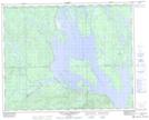
Maps showing Lac Entre-Deux, Rivière-Mouchalagane; Caniapiscau, Quebec
Lac Entre-Deux is a Lake located in Rivière-Mouchalagane; Caniapiscau, Quebec.
- Latitude: 51° 55' 19'' North (decimal: 51.9220138)
- Longitude: 67° 52' 23'' West (decimal: -67.8730237)
- Topography Feature Category: Lake
- Geographical Feature: Lac
- Canadian Province/Territory: Quebec
- Location: Rivière-Mouchalagane; Caniapiscau
- Atlas of Canada Locator Map: Lac Entre-Deux
- GPS Coordinate Locator Map: Lac Entre-Deux Lat/Long
Lac Entre-Deux NTS Map Sheets