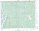
Maps showing Lac de la Question, Rivière-Mouchalagane; Caniapiscau, Quebec
Lac de la Question is a Lake located in Rivière-Mouchalagane; Caniapiscau, Quebec.
- Latitude: 51° 56' 25'' North (decimal: 51.9403447)
- Longitude: 68° 0' 18'' West (decimal: -68.0049655)
- Topography Feature Category: Lake
- Geographical Feature: Lac
- Canadian Province/Territory: Quebec
- Location: Rivière-Mouchalagane; Caniapiscau
- Atlas of Canada Locator Map: Lac de la Question
- GPS Coordinate Locator Map: Lac de la Question Lat/Long
Lac de la Question NTS Map Sheets