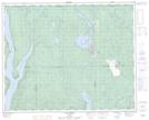
Maps showing Colline du Croissant, Rivière-Mouchalagane; Caniapiscau, Quebec
Colline du Croissant is a Mountain located in Rivière-Mouchalagane; Caniapiscau, Quebec.
- Latitude: 51° 57' 17'' North (decimal: 51.9547858)
- Longitude: 68° 14' 7'' West (decimal: -68.2352414)
- Topography Feature Category: Mountain
- Geographical Feature: Colline
- Canadian Province/Territory: Quebec
- Location: Rivière-Mouchalagane; Caniapiscau
- Atlas of Canada Locator Map: Colline du Croissant
- GPS Coordinate Locator Map: Colline du Croissant Lat/Long
Colline du Croissant NTS Map Sheets