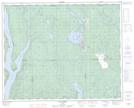
Maps showing Lac du Gneiss Folié, Rivière-Mouchalagane; Caniapiscau, Quebec
Lac du Gneiss Folié is a Lake located in Rivière-Mouchalagane; Caniapiscau, Quebec.
- Latitude: 51° 57' 59'' North (decimal: 51.9664555)
- Longitude: 68° 5' 30'' West (decimal: -68.0916325)
- Topography Feature Category: Lake
- Geographical Feature: Lac
- Canadian Province/Territory: Quebec
- Location: Rivière-Mouchalagane; Caniapiscau
- Atlas of Canada Locator Map: Lac du Gneiss Folié
- GPS Coordinate Locator Map: Lac du Gneiss Folié Lat/Long
Lac du Gneiss Folié NTS Map Sheets