Maps showing Mishomis Sìbì, Gatineau; Gatineau, Quebec
Mishomis Sìbì is a River located in Gatineau; Gatineau, Quebec.
- Latitude: 45° 27' 13'' North (decimal: 45.4536629)
- Longitude: 75° 41' 43'' West (decimal: -75.6952272)
- Topography Feature Category: River
- Geographical Feature: Rivière
- Canadian Province/Territory: Quebec
- Location: Gatineau; Gatineau
- GPS Coordinate Locator Map: Mishomis Sìbì Lat/Long
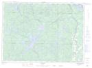
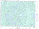
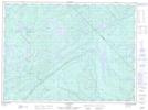
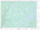
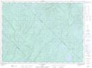
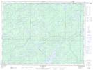
Mishomis Sìbì NTS Map Sheets
031F16 Kazabazua Topographic Map at 1:50,000 scale
031G05 Ottawa Topographic Map at 1:50,000 scale
031G12 Wakefield Topographic Map at 1:50,000 scale
031G13 Low Topographic Map at 1:50,000 scale
031J04 Bouchette Topographic Map at 1:50,000 scale
031J05 Maniwaki Topographic Map at 1:50,000 scale
031J12 Grand-Remous Topographic Map at 1:50,000 scale
031J13 Reservoir Baskatong Topographic Map at 1:50,000 scale
031K01 Blue Sea Lake Topographic Map at 1:50,000 scale
031K09 Montcerf Topographic Map at 1:50,000 scale
031O04 Lac Petawaga Topographic Map at 1:50,000 scale
031O05 Lac Wapus Topographic Map at 1:50,000 scale
031O06 Lac Duplessis Topographic Map at 1:50,000 scale
031O11 Lac Nasigon Topographic Map at 1:50,000 scale
031O12 Lac Des Augustines Topographic Map at 1:50,000 scale
031O13 Lac Echouani Topographic Map at 1:50,000 scale
031F Pembroke Topographic Map at 1:250,000 scale
031G Ottawa Topographic Map at 1:250,000 scale
031J Mont-Laurier Topographic Map at 1:250,000 scale
031K Deep River Topographic Map at 1:250,000 scale
031O Lac Kempt Topographic Map at 1:250,000 scale