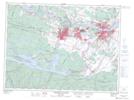
Maps showing Centrale Murdock-Wilson, Saguenay; Saguenay, Quebec
Centrale Murdock-Wilson is a Hydraulic construction located in Saguenay; Saguenay, Quebec.
- Latitude: 48° 28' 0'' North (decimal: 48.4667103)
- Longitude: 71° 14' 10'' West (decimal: -71.2362045)
- Topography Feature Category: Hydraulic construction
- Geographical Feature: Centrale hydroélectrique
- Canadian Province/Territory: Quebec
- Location: Saguenay; Saguenay
- Atlas of Canada Locator Map: Centrale Murdock-Wilson
- GPS Coordinate Locator Map: Centrale Murdock-Wilson Lat/Long
Centrale Murdock-Wilson NTS Map Sheets