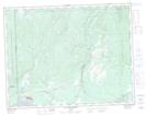
Maps showing Fosse Molly-Adams, Sept-Îles; Sept-Rivières, Quebec
Fosse Molly-Adams is a River feature located in Sept-Îles; Sept-Rivières, Quebec.
- Latitude: 50° 17' 19'' North (decimal: 50.2886606)
- Longitude: 66° 11' 46'' West (decimal: -66.1960538)
- Topography Feature Category: River feature
- Geographical Feature: Fosse à saumon
- Canadian Province/Territory: Quebec
- Location: Sept-Îles; Sept-Rivières
- Atlas of Canada Locator Map: Fosse Molly-Adams
- GPS Coordinate Locator Map: Fosse Molly-Adams Lat/Long
Fosse Molly-Adams NTS Map Sheets