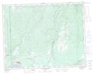
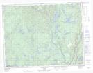
Maps showing Le Cran Serré, Rivière-Nipissis; Sept-Rivières, Quebec
Le Cran Serré is a Channel located in Rivière-Nipissis; Sept-Rivières, Quebec.
- Latitude: 50° 34' 5'' North (decimal: 50.5681072)
- Longitude: 66° 8' 49'' West (decimal: -66.1468831)
- Topography Feature Category: Channel
- Geographical Feature: Passe
- Canadian Province/Territory: Quebec
- Location: Rivière-Nipissis; Sept-Rivières
- Atlas of Canada Locator Map: Le Cran Serré
- GPS Coordinate Locator Map: Le Cran Serré Lat/Long
Le Cran Serré NTS Map Sheets