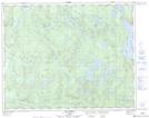
Maps showing Lac de la Pointe en Flèche, Lac-Jérôme; Minganie, Quebec
Lac de la Pointe en Flèche is a Lake located in Lac-Jérôme; Minganie, Quebec.
- Latitude: 51° 18' 33'' North (decimal: 51.3091667)
- Longitude: 62° 20' 39'' West (decimal: -62.3441667)
- Topography Feature Category: Lake
- Geographical Feature: Lac
- Canadian Province/Territory: Quebec
- Location: Lac-Jérôme; Minganie
- Atlas of Canada Locator Map: Lac de la Pointe en Flèche
- GPS Coordinate Locator Map: Lac de la Pointe en Flèche Lat/Long
Lac de la Pointe en Flèche NTS Map Sheets