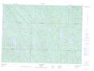
Maps showing Baie Laplante, Lac-du-Cerf; Antoine-Labelle, Quebec
Baie Laplante is a Bay located in Lac-du-Cerf; Antoine-Labelle, Quebec.
- Latitude: 46° 16' 15'' North (decimal: 46.2708862)
- Longitude: 75° 32' 44'' West (decimal: -75.5454906)
- Topography Feature Category: Bay
- Geographical Feature: Baie
- Canadian Province/Territory: Quebec
- Location: Lac-du-Cerf; Antoine-Labelle
- Atlas of Canada Locator Map: Baie Laplante
- GPS Coordinate Locator Map: Baie Laplante Lat/Long
Baie Laplante NTS Map Sheets