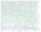
Maps showing Île aux Lièvres, Lac-Jérôme; Minganie, Quebec
Île aux Lièvres is a Island located in Lac-Jérôme; Minganie, Quebec.
- Latitude: 50° 28' 18'' North (decimal: 50.4717354)
- Longitude: 62° 31' 9'' West (decimal: -62.5192773)
- Topography Feature Category: Island
- Geographical Feature: Île / Ile
- Canadian Province/Territory: Quebec
- Location: Lac-Jérôme; Minganie
- Atlas of Canada Locator Map: Île aux Lièvres
- GPS Coordinate Locator Map: Île aux Lièvres Lat/Long
Île aux Lièvres NTS Map Sheets