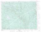
Maps showing Baie du Soleil, Rivière-aux-Outardes; Manicouagan, Quebec
Baie du Soleil is a Bay located in Rivière-aux-Outardes; Manicouagan, Quebec.
- Latitude: 49° 34' 55'' North (decimal: 49.5819926)
- Longitude: 67° 52' 6'' West (decimal: -67.8683441)
- Topography Feature Category: Bay
- Geographical Feature: Baie
- Canadian Province/Territory: Quebec
- Location: Rivière-aux-Outardes; Manicouagan
- Atlas of Canada Locator Map: Baie du Soleil
- GPS Coordinate Locator Map: Baie du Soleil Lat/Long
Baie du Soleil NTS Map Sheets